BULLETIN NO 1 from Auckland 23rd Jan 2006
 |
|
The Auckland waterfront |
Hello everyone,
Well I’m finally in Auckland, NZ after a very pleasant and relaxing trip from Los Angeles aboard the good ship “CP Tui”. We landed last Thursday and after spending the W/E with friends in Hamilton getting acclimatized, I think I’m ready to take off on my first tramp – the Tongariro Northern Circuit. This is a four day tramp amid volcanoes and thermal areas and it should be very interesting. I’ve never seen anything even remotely like this before. This area and Mt. Ngauruhoe (which I might climb if I have time) featured as the Plains of Gorgoroth and Mount Doom in the evil land of Mordor in the “Lord of the Rings”. Which makes you wonder why anyone would want to go there! But the one-day Tongariro Crossing (which is part of the circuit) is supposedly the most popular day walk in New Zealand. And everyone can’t be wrong.
I’m going to try a different method of keeping in touch this time. While I was on the ship, I spent some of my copious free time trying to design a web site – the idea being to include all the journals and photos of my various tramps in one place. I didn’t manage to finish it completely but I uploaded it such as it is, and I’m going to try and keep the New Zealand part updated as I go along. Part of the idea behind this is many of my friends have high-speed internet but some don’t. And those that don’t sometimes get annoyed when I clog up their e-mail accounts and tie up phone lines with megabytes of photos. If all the photos are on a web site you can look at them if you want and not if you don’t. There’ll be a thumbnail of each one to give you an idea of what the big picture would look like.
I’ve also featured some music on some of the sections, but I don’t know how this will affect people with slow speed internet. If it’s annoying, please let me know and I’ll take it off.
More later.
Chris
 |
|
Mount Ruapehu erupting back in 1996 |
BULLETIN NO 2 from Whakapapa Village - 28th Jan 2006
Here I am at the Skotel Alpine Resort in Whakapapa (pronounced, surprisingly – Fokkerpopper! - "wh" in NZ sounds like an "f"). This is the highest hotel in New Zealand and right at the centre of the Tongariro National Park - a World Heritage site and one of the most fascinating places I've seen. This whole area has cultural and religious significance for the Maori people and symbolizes the spiritual links between this community and its environment. The park has active and extinct volcanoes, a diverse range of ecosystems and some spectacular landscapes.
I ought to be in a mountain hut on the Tongariro Northern Circuit, but I had a major piece of bad luck when I was about to set off on my walk. I was just hoisting my (maybe overloaded) pack on to my shoulders to set off and I wrenched my back. It hurt a lot after that to get it on but surprisingly once it was on it felt fairly comfortable. I decided to carry on and got to the first hut - Mangatepopo Hut, with a wonderful view of the mountains (and another lovely sunset). There was a veritable United Nations there - Japanese, French, German, Israeli, American and of course Canadian. The volunteer hut warden was Canadian too, from Tobermory. My back was still hurting a bit but not too bad. The next morning I decided to set off again and I'd got to the top of the climb up to the Mangatepopo saddle and now it was starting to hurt quite a bit. On top of that it was a scorchingly hot day and I'd got through two-thirds of my 3 litres of water and I'd only been going 2 hours with another 3.5 to go, and it was as hot as a cauldron up there on the south crater. Very reluctantly I decided to turn around and go back down to the hut where I'd have various options for the next move. Amazingly, with liberal doses of Vitamin "I" (Ibuprofen) I wasn't hurting much at all. Back at the hut I had a good lunch and filled up again with water. There I decided to walk back again to the Village. And so ended my attempt at the Tongariro Northern Circuit.
Now I'm planning to rest up and hope that my back gets better. I want to be in good shape for the Milford Track and the Routeburn at the beginning of Feb.
Must stop now - my time has run out
Chris
BULLETIN NO No 3 from Rotorua 30th Jan 2006
 |
|
The Prince of Wales geyser - Rotorua |
Thanks to all for your kind wishes about my back. I think it’s on the mend and even though it’s disappointing not to be tramping, it does have its compensations - at least it gives me a perfect excuse to be lazy!
Since my last bulletin, I’ve been mainly sightseeing, lolling around in thermal baths and doing easy gentle walks. Yesterday I had a very interesting trip around the “Craters of the Moon” site near Taupo. They explained in the blurb that this site, which consists of multiple steam vents (or fumaroles) spread out over a multi-acre site, came to life after the nearby Wairakei Geothermal Power Station was commissioned in 1958 and took away most of the steam. Before that, the activity had been confined to one geyser, which is now extinct. This got me wondering - if the pressure is now less than it was, why did all these new steam vents appear, when there was just one before? The man at the information booth didn’t know, and neither did the girl at the Wairakei Power Station Information centre. I could’ve got a trip round the power station for $90. But although a trip round that plant would’ve been very interesting, I thought was a bit much just to satisfy my curiosity, when I can probably do that for free on the internet.
After that, I headed over to the Whirinaki Forest Park east of Taupo, which offers a pleasant one-day walk as well as what my book told me was the best example of old-growth native forest in New Zealand.
On the way, I bumped into a couple of old “whakas” who gave me a glimpse of another side of friendly New Zealand. I’d stopped to take a picture of what to me was an unusual kind of tree, which I’d seen before and didn’t know what it was – a sort of tree growing within a tree growing within a tree. I asked a woman who was sitting nearby in a car what it was. Turned out it was a common and garden old gum tree imported from Australia. I told her I was going to the Whirinaki Forest Park and she didn’t know where it was, so I showed her on the map.
“Oh”, she said, “you’re going to Minginui. I wouldn’t do that if I were you”.
“And why not?”, I asked, reasonably.
“Well, it’s full of brown people” she replied.
Then she yelled over to her husband who was nearby fiddling with a tractor. “Hey, this man wants to go to Minginui”.
He turned and looked at me askance. “Huh! You want to go to Minginui? You got your 303 with you?”.
Well, after that exchange I didn’t know quite what to think. I’m still not quite sure if they were racist bigots, or whether they were pulling my leg, or whether they were deadly serious and concerned for my safety. Or maybe a bit of all three. I find it strange that Kiwis often seem to be damning their own beautiful country. I’m continually being warned about thieves and vandals infesting the trailheads, now it seems I have to look out for murderous “brown people!”
Well, off I went anyway, like a lamb for the slaughter, to Minginui, and as you see, I survived! In fact, this old-growth forest was beautiful - sublime. Huge stately old trees, none of which I’ve ever seen before, and with names I didn’t recognize either – podocarp trees such as rimu, kahikatea, matai, and miro. There is a timeless sense of peace here and all negative thoughts are quickly forgotten. I left here refreshed and renewed.
I then drove to Rotorua, spent the night there, and spent this morning looking at fine old geysers and bubbling mud pools. What an amazing place. It’s a very touristy town of course, but well worth the visit because it’s truly unique, at least in my experience. There’s a faint smell of sulphur in the air which is not at all unpleasant, and my motel room has its own airy patio at the front, screened by waving palm trees and a naturally heated thermal hot tub in a screened-in area at the back. It also has wireless internet which is a big boon for me, because it’s about the only way I have for keeping in touch. Hence the long screed this time.
Incidentally, I’ve tried to find out on the internet about the Mystery of the Craters of the Moon and, although I’ve learned a great deal about plate tectonics, the geological history of New Zealand, and the reasons for all the thermal activity around here, so far nothing on the sudden apparition of the Craters of the Moon. Now if anyone knows anything about it, could they let me know, please?? – it’s needling me!! Thanks.
On Feb 1st I fly down to Queenstown and I start on the Milford Track on Feb 3rd, after that the Routeburn, which I finish on Feb 10th. After that I don’t know – rather depends on whether I’m cured or whether I’m a physical wreck by then. I might even be back in Canada sooner than I’d planned.
More to come,
Chris
BULLETIN NO 4 from Te Anau 7th Feb 2006
 |
|
Hirere Falls - Milford Track |
I've just got back from an absolutely glorious tramp along the Milford Track and I set off tomorrow on the Routeburn Track. This is the life. The weather was perfect and the scenery is indescribable. I've taken lots of pictures but I know they won't even start to do it justice. If you want to know what it's like, you're just going to have to do it yourselves!
The tramp was 4 days long, up and over McKinnon pass, the high pass that connects Lake Te Anau with Milford Sound and the sea. There is a tremendous variety of scenery, including Sutherland Falls, which is the highest waterfall in New Zealand and the fifth-highest in the world - and this was just one of many delights. They call it the "finest walk in the world", and if it’s not, it must come close, very close.
And I'm pleased to report my back is no longer an issue. The day before I started it was still acting up and I was wondering if I was going to be able to make it, but as soon as I started walking I didn't feel any more from it. It's amazing how walking seems to cure so many problems. I went with an organized group, which was the only way I could do it. The places for independent walkers are booked up months in advance, whereas the group I was with actually had spare room. It's expensive the way I did it but they spoil you rotten. All meals provided and very little to carry. The lodges are palatial by mountain standards, and you can order beer and wine when you arrive. In one of the lodges they even had a piano roll piano and we had a sing-song round the piano, taking it in turns to pump the pedals - which was damn hard work - even for us fit and healthy walkers! It was a fun group of people too, Australian, New Zealand, British, American, Japanese, and one poor Korean guy who couldn't speak a word of English, but seemed to be enjoying himself hugely. I shall miss them, in just four days we were like old friends.
Must stop now before my time runs out again. They have a nasty habit of just shutting you off here.
More to come
Chris
BULLETIN NO 5 from Dunedin 12th Feb 2006
 |
|
On top of Conical Hill - highest point on the Routeburn Track |
Here I am in Dunedin, the “Edinburgh of the South” as it is called, because of the stately buildings and the fact it was originally settled by the Scottish. The Scottish burr is still supposed to be recognisable here, although I haven’t detected it. Talking of accents, it’s interesting to note there are distinct differences between Kiwispeak and “strine”, which after passing several days with both, even I was able to hear. In Kiwispeak the vowel sounds seem to be shifted, “hat” becomes “het”, “yes” sounds like “yis”, and “fish” sounds a bit like “fursh”. On my last tramp, our pretty young guide, Katherine, caused a lot of hilarity during our morning briefing by saying “when you get to the T-junction, take the lift”. The facilities on the Routeburn were impressive, but nobody knew they were that good! I also find it interesting that throughout New Zealand they tend to end their sentences with the interrogative inflexion, even adding an “eh?”, like Canadians sometimes do. I mooted my theory that this is a sign of modesty - of not expecting or requiring others to agree with you. This theory was shot down in flames when I was told that that the “eh?” was more common in the North Island than in the South, and North Islanders were far from modest!
But I digress. As you will have noticed I have just finished another glorious tramp on the Routeburn. I was extremely lucky to get on two of New Zealand’s most famous tramps back to back at very short notice and to have picked a time when the weather was almost perfect – at least for me. I was dreading a repeat of the oven-like conditions that I met on the Tongariro circuit, but in both cases, the above-tree-line sections of the tramp were blessed with cloudy skies and a merciful breeze. The only rain we saw for the whole time was when we were happily ensconced in one of the welcoming lodges along the way, quaffing down a beer.
People kept on asking me which tramp I preferred between the two, and I have to say the Milford, simply because it was longer. Both were thoroughly delightful and both were over too soon. The Milford is a four-day tramp and the Routeburn is three-day. They are somewhat similar in character, starting going up one river valley, over a high pass and ending by walking down another valley. So at the beginning and end you are treated to lush rain forest, sparkling waterfalls and rushing rivers, while in the middle there is the steep and rugged alpine crossing way above the tree line with spectacular views in all directions. There was another noticeable difference between the two and that is that although the Milford is more popular and accommodates more trampers, you see far fewer people along the way. The reason for this is that on the Milford you are only allowed to walk one way, whereas on the Routeburn you can walk either way. And on the Milford, both ends can only be reached by boats which run to a timetable, whereas on the Routeburn they can be reached by cars, which don’t. Some people complain about the regimentation (and cost) of tramping the Milford, but all that annoyance you can get out of the way ahead of time. After that you can relax and enjoy yourself.
There’s a veritable cornucopia of tracks to tramp based in Queenstown, but having already done the two most famous, and not finding Queenstown to my taste, I decided to move on. Along the way, I often ask other trampers what they think I should do next. No less than six people have all independently suggested the Queen Charlotte Track. So I have taken this as a sign and I’m making my way there. The Queen Charlotte Track winds along the coastline of the Queen Charlotte Sound at the north-east tip of the South Island. It goes from one fishing port to another and all are serviced by boat. There is a variety of accommodation at each port, and there is even the possibility of doing one or more sections by sea-kayak. This is all very interesting, but a bit complicated. I’m trying to make up my mind whether to join another guided walk or try to make all the arrangements myself. My guidebook laconically states that you should make all the arrangements ahead of time, which is easier said than done when you don’t know what arrangements to make! I may just rely on the fact that it’s starting to get a bit late in the season here and I may try and wing it. Camping would’ve been a good option and I’m beginning to regret now that I left my tent and air mattress in Hamilton – but maybe I’ll be able to rent one. These guided trips are nice but they are very expensive, and sometimes I think you have more fun if you’re less in control and more open to encounter. On the Milford there were two classes - us guided walkers, the “soapies” as we were called, and the independent trampers, the “stinkies”. I mixed a bit with the slower stinkies as we caught them up along the way and I think I got on better with them. Much as I enjoyed the luxury of having our meals cooked for us and a cool beer at the end of the day, somehow I think I’m more of a “stinky” at heart!
I drove east from Queenstown, watching the stark mountains gradually giving way to the more gentle scenery of the east coast. I’m now in Dunedin and intending to drive up the coast to Picton where the Queen Charlotte Track is based. Along the way, I hope to see some whales, dolphins, albatrosses and above all penguins. After having seen “The March of the Penguins” I have great esteem for penguins and I’d love to see some in the wild.
But I’ve got to hit the road so I should stop now before I blather on all day.
Chris
BULLETIN NO 6 from Motueka March 1st 2006
 |
|
Sunrise from Onetahuti beach - Abel Tasman Track |
G’day all,
Sorry I haven’t been in touch for a long time. This is because I’ve been on the go almost non-stop since my last bulletin. I’m in Motueka now and I’m writing this on my laptop in the hope I’ll find an internet café with wi-fi so I can send it.
I’m in seventh heaven here. I just can’t think of enough superlatives to describe New Zealand. It truly has it all. I’m up at the north end of the South Island and I’ve just finished doing three tracks one after the other; the Queen Charlotte Track, the Heaphy Track and the Abel Tasman Coastal Track. The weather has been perfect the whole time and all the tramps were out of this world.
The Queen Charlotte Track is probably the easiest and most luxurious walk I’ve ever done in my life. You have to get the start and be picked up at the end by water taxi and the price of the water taxi ticket includes their transporting your pack for you to each night’s accommodation – so you only have to carry a day pack. Each night you have a choice of accommodation options, everything from backpacker’s bunkhouses, B&Bs, homestays, to luxury resort hotels. I opted for the backpacker’s bunkhouses because that’s where you meet the interesting people, but we did profit from the bar at the luxury resorts for a beer each evening. The water taxi base for the track is Picton, a pretty little town which is also the southern terminus of the Interislander ferries. The water taxi drops you off at Ship Cove near the north of the peninsula, so named because Captain Cook used to careen his ships here. Thence it gradually works its way along the ridge of the narrow isthmus between the Queen Charlotte Sound and the Kenepuru Sound to finish at the little village of Anakiwa where the water taxi picks you up. On the way, I stayed at Furneaux Lodge in the Endeavour Inlet, Punga Cove, and the bunkroom at the luxurious Portage Resort Hotel. Since the track is mostly high up on the ridge and the isthmus is fairly narrow, the views almost at every bend in the track were superb, first of one side then the other and sometimes both at the same time. I almost got tired of continually having to stop to take photos! I just hope that some of them do it justice. The walking was very easy and pleasant and as I walked I enjoyed listening to what I called the Queen Charlotte Symphony – the constant shrill of the cicadas, punctuated by bursts of melodic singing of the birds, and occasionally counterpointed by the rhythmic beating of waves on the shore.
The Heaphy Track is another Great Walk - quite remote - traversing as it does the rugged Kahurangi National Park from Golden Bay to the west coast. The track is 82km long and you end up 500km by road from where you started. There was a jolly group of five Ozis on this track, three of whom were doctors and the other two paramedics. In fact, what with another Kiwi from Queenstown who was also a medic, staying at the huts we had no less than four doctors and two paramedics! We were joking that if anyone felt like getting sick or having an accident, now was the time to do it. But the medics weren't having any of that!
Apropos, I asked the warden at the first hut whether he thought the water out of the streams was safe to drink, and his answer was “Hill, yis, mite!” How refreshing to get an honest answer to an honest question. And I don’t think he was being cavalier; he was just telling me what he would do. There is a presumption in New Zealand that people will use common sense, take responsibility for their actions, and not try and blame someone else for their own stupidity. I couldn’t help contrasting that with the evasive, legalistic, CYA answer I got from a Gatineau Park ranger last winter when I asked him if he thought the ice was safe to ski on. He said something like “Our official answer to that question is that no ice is safe to ski on, anytime, anywhere”. Not at all helpful, and rather absurd in light of the fact I found out subsequently that the typical ice at the time was over 18 inches thick! New Zealand has a government run system called ACC (Accident Compensation Commission). If you have an accident you’ll get reasonable compensation from the government in lieu of any right of action against others. This “no-fault” system puts a stop to all the frivolous and greedy lawsuits we get in Canada, and above all, it frees landowners, volunteers, good Samaritans etc. from the fear that by helping people or letting them walk across their land they open themselves to the risk of being sued.
While on the subject of New Zealand mores, I’m very impressed by the conservation mindset of the people here. They pride themselves on being “greenies” - they switch out lights, they take public transport, they walk or ride bikes, and another little thing which impressed me – they don’t let the water run while they’re brushing their teeth! The place where I’m staying now has a washing machine but no dryer – the owner said why buy a dryer when there’s a perfectly good sun up there for free.
To get back to the Heaphy Track, it is advertised as being the Great Walk with the widest variety of scenery, starting with native forest up to a sub-alpine crossing, through tussock downs, secluded river valleys, ending with a beautiful 12km tramp along a beach lined with nikau palms. I spent my 66th birthday at the Heaphy Hut, which I thought was rather appropriate. Strangely there was an American woman who had her 40th the next day, and one of the Ozi doctors had her birthday the day after – she didn’t let on which one though! Because of the distance back to the beginning, we had to spend the night in Karamea and get a bus the next morning back to Nelson. Far from being a bore, this turned out to be an extra pleasure because by then we were all good friends and we had the evening celebrating at the pub in Karamea and most of the bus to ourselves the next morning.
After that, with a quick stop in Nelson to resupply, I drove up to Marahau to start another Great Walk – The Abel Tasman Coast Track. This was also very enjoyable, but probably less than the other two. This was mainly because it was pretty crowded with kayakers, who surprisingly enough didn’t really seem to fit in very well with the trampers. I had thought I might do a bit of kayaking myself but thought better of it when I realized that in those short sections of track where there was no tree cover I started to burn very quickly. In a kayak, I would’ve had to put up with that all day and I don’t think I could’ve stood it. I should’ve mentioned earlier that there has been very little rain while I’ve been here – hardly even any cloud in the sky. I know I shouldn’t complain, but what with the hole in the ozone layer here, the sun can be literally murderous. They have an adage here which kids are supposed to learn at an early age - they call it “slip, slop and slap”; slip on a shirt, slop on some sun cream, and slap on a hat. In spite of this, I saw many people, maybe foreigners, lying like beached whales roasting themselves on the sand.
The Abel Tasman Track has an unusual little wrinkle, which is that there are a few tidal crossings which are either impossible or require a lengthy detour to get around at high tide. Going from Awaroa Hut to Anchorage Hut there were two of these, one near the beginning and one near the end. Rather than kick my heels all morning and hike like hell to arrive very late at Anchorage Hut, I took the unusual course of starting at 4:45 in the morning; hiking by headlamp to take the first crossing at Onetahuti on the morning tide and the second one at Torrent Bay on the afternoon tide. This made for a very relaxed hike as I actually had to walk slowly not to arrive too soon at Torrent Bay. Everyone at Awaroa Hut thought I was crazy, but none of them had ever tried walking in the dark by headlamp so I didn’t go much on that. It is an eerie delight and adventure, especially on a track you’re not familiar with, and I maintain it’s perfectly safe as long as you take reasonable care (although I must say the GPS was a comfort – at least I knew I could retrace my steps if I had to). On top of that, I was treated to the unexpected pleasure of a sunrise while walking along the beach at Onetahuti Bay with the famous Marine Reserve of Tonga Island silhouetted against the sky. I think it’s one of my best photos.
And here I am back in Motueka trying to digest all these experiences and to think about the next move. Much as I might like to I can’t spend the rest of my life here – in three months I'll be deported! I think I’ll head back to the North Island and take in a couple more walks there before heading home. I’m thinking of Lake Waikaremoana or the Coromandel Forest Park, or maybe now I’m back in good shape again I may have another go at the Tongariro Northern Circuit.
I’ll try and get in touch again next time without such a long delay.
Chris
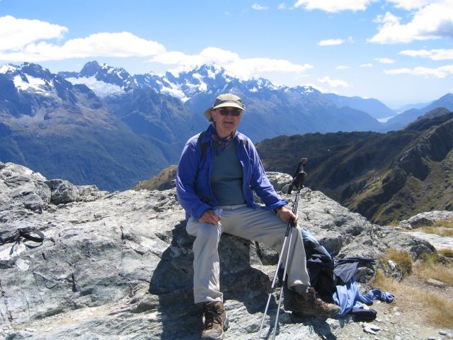
BULLETIN NO 7 from Gisborne March 13th 2006
 |
|
The Red Crater - Tongariro Northern Circuit |
G’day all,
A lot’s happened since my last bulletin. I crossed over to the North Island by ferry and I’ve since completed the only two Great Walks on the North Island – the Tongariro Northern Circuit (the same one I tried to do earlier and turned around because of back problems) and the Lake Waikaremoana Track. I’ve now done all the Great Walks in New Zealand except two – the Kepler Track in Fiordland and the Rakiura Track on Stewart Island.
I certainly didn’t start out with the intention of doing all the Great Walks, it just seemed to happen that way. But I think it made sense; the Great Walks are after all New Zealand’s best walks and have been specially selected for their varied and outstanding scenery. There are so many tracks to pick from, why not let New Zealanders themselves help make the choice! A big factor for me too was that I was fairly sure of meeting plenty of pleasant people on the Great Walks – an important consideration when you’re hiking on your own.
My hike on the Tongariro Northern Circuit was quite an adventure. When I went to get my hut pass at Whakapapa Village the DOC (Department of Conservation) guy told me that in the next four days the weather forecast only called for one fine day. Since that would be the third day of my hike he recommended that I do it anti-clockwise so as to make the high crossing on that one fine day. I set off the next day towards Waihohonu hut to overcast skies and high winds, which very quickly turned into driving snow. The visibility was very poor so I felt rather than saw the looming, threatening presence of Mount Ngauruhoe (Mt. Doom) on my left. The snow wasn’t too bad actually because it was dry and cold so instead of getting soaked it just bounced off my clothes and pack. And it didn’t settle on the ground much so the going was fairly easy if a little hard pushing against the wind.
There was a jolly group of Kiwis at the hut, all going in the opposite direction. We played a game I hadn’t played before called “Pass The Pig” or “Pig-Out” (I’m not sure which) which merely consisted of tossing two small plastic pigs in the air and getting points depending on which way they land. This has to be the perfect game for the trail – weighs next to nothing, no skill or mental effort required, any number can play, and hilarious fun all round. I must try and buy it next time I’m in a town.
Anyway, to get back to the tramp, the hut warden gave us the latest weather forecast that evening and sure enough, the day after tomorrow was still forecast fine, but what the DOC guy hadn’t told me was that that they were forecasting a full gale around the craters. Even the next day was going to be pretty tough going, completely exposed with intermittent showers and gusts between 65 and 90 Km/hr. I was the only one going anti-clockwise which made me a little uneasy, but I didn’t think I could come to much harm as it wasn’t a hard section and I could always turn around. So I set off and the wind seemed to get stronger and stronger and before I got to the Oturere hut I was veering and staggering around like a drunk. I had wondered if I would go on to the Ketetahi hut, but some young guys came in for their lunch saying it was really tough going up at the top and they’d seen nothing because of the clouds. So I decided to stay put, and I thought I was going to have the place to myself until a nice Scottish couple, Alex and Gillian, arrived quite late having come all the way from Whakapapa Village going anti-clockwise like me. I was very glad to see them as it meant I’d have some company for what looked like a very tough hike the next day, that’s if we could move at all. The location was completely exposed and the wind got stronger and stronger until the whole hut was shaking, rattling, banging and cracking. The Scottish couple, who it turned out were both civil engineers, began to wonder out loud if the hut was going to blow away! We discussed what we’d do if the hut started to disintegrate - such as hiding under the beds or even taking shelter in the toilets! I pointed out, for my own reassurance as much as anything that the hut had been there since 1970 and surely it’d withstood worse than this? The shaking, rattling and banging went on all night and, unusually for me, I didn’t get a wink of sleep until near dawn when I dropped off from sheer exhaustion. The Scottish couple woke me up around 8:00 and miraculously the wind had dropped, the sun was shining and the hut was still standing! And right outside the window was the vast cone of Mount Ngauruhoe clear as daylight with not a speck of cloud on it. Time to get going fast.
So after the sleepless night worrying about the next day, it turned out to be a glorious hike and I finally got to see those beautiful Emerald Lakes and the amazing and rather sinister Red Crater The wind was strong at the top but less than yesterday and quite manageable. Then a stroll across the huge flat amphitheatre of the South Crater. I wasn’t at all tempted to climb Ngauruhoe, which looked like damned hard work and was in any case covered in cloud at the top by now, and so down the steep Devil’s staircase, which I’d already negotiated twice on my abortive first attempt. The walk out to Mangatepopo hut was a gentle stroll along boardwalks most of the way. And then another merry group at the hut – how I love these huts, the camaraderie and the interesting people you find there. I think they will be one of my best recollections of New Zealand.
The next day it was slashing with rain as we walked together along “the ditch” as they call it back to the Village. I’d already walked this twice before so I knew it well. And although it needed a bit more care in the wet it wasn’t at all as the guide books said (3 hours normally, 5 hours in bad weather). I actually did it faster than I did it last time, so my bad back was slowing me up more than the mud. What a superb tramp this was, what an adventure! In four days I’d had just one day of good weather, but it was the one which mattered, and I counted myself lucky. We arrived sopping wet, very bedraggled but very happy back at the Skotel and after a quick clean up it was straight to the bar to enjoy a few pints of Monteith’s Original with Alex and Gillian. I left the next day to drive to Lake Waikaremoana. Alex and Gillian squeezed into my little car with all their luggage and on the way I dropped them off at Taupo.
The Lake Waikaremoana Track didn’t bode too well at the start. The trailhead is really out of the way - 60km from the nearest town up a mostly dirt road. There was hardly any traffic and the night before I was the only person at the backpacker’s (a sort of cheap hostel that they have all over New Zealand). The next morning I was beginning to wonder if I would be tramping the whole way on my own but, as I was getting ready to leave, a psychedelic passion wagon rattles up and two tattooed youths in dreadlocks emerge. Oh no! This could be worse! They answered my greetings with monosyllabic grunts, hefted their packs and started off – and that was the last I saw of them – thank God! Strangely enough none of the people that I later met going in the opposite direction had seen them either – very odd.
I didn’t meet anyone all the way to the first hut and it was deserted when I arrived, but later it gradually began to fill up with a jolly and noisy bunch of people, mostly going in the opposite direction – they were playing the same “knock knock” game that those of us on the Chic-Chocs hike last year remember well. Then very late in the day, a delightful couple from Auckland arrived (Andrew and Sarah), who turned out to be very keen singers – a soprano and a tenor. They’d also done the Milford Track and when I told them our Saguenay Fjord hike is in many ways comparable and just as nice, they seemed keen to do it. If I ever get up another group to hike the Saguenay Fjord I’ll try and get them to come and I must find a tramping alto too, so we can sing madrigals and part-songs along the way.
It was in talking to these two that I got an answer to a question that has been puzzling me for some time. I mentioned in one of my previous bulletins that in New Zealand “wh” is pronounced like an “f”. My question was why? The Maoris clearly didn’t use our alphabet before the first European settlers arrived, so if all these Maori “wh” sounds were meant to be pronounced as an “f” why wasn’t it transcribed that way in the first place? I think these two had an answer and though they admitted they weren’t sure, it seems reasonable. It seems the “wh” was used to describe a sound which doesn’t really exist in the English language – a sort of soft “f” sound such as you get by aspirating between your two lips instead of between your upper teeth and your lower lip. Since this sound didn’t really exist in the English tongue the best that the early transcribers could come up with to describe it was “wh”, as in “whew”. Over the years it got corrupted to a vocalized “wh” sound, as in “why”, and because Europeans generally had little interest in pronouncing Maori words correctly that was the way it stood until the 1970s, when a movement started to bring the Maori language back from the brink of extinction. But even now the confusion still exists, witness the city of Wanganui at the mouth of the Whanganui river, reflecting the different pronunciations of Maori and Europeans.
Sorry – another digression. To get back to the tramping, it was a surprise to me that the Lake Waikaremoana track was in some ways the hardest walk I’ve done since I’ve been here. Although I thoroughly enjoyed it, the track maintenance was not up to the standard of the other Great Walks and it was heavily eroded in places, particularly in steep places, making them steeper still and more hazardous, particularly when you had to thread your legs between a spaghetti of exposed tree roots down to the steep slippery mud below, grabbing onto whatever handholds you could find to give some support and haul yourself up. The first two days going over the Panekiri ridge there was a great deal of this. At one stage the track was particularly hair-raising as it went right along the edge of a precipitous 500-metre drop-off. The thing that really horrified me was that I hadn’t immediately noticed this and was blithely walking along while that treacherous drop off was concealed by tall thick grass growing along the edge and over the track. Sometimes I had to part the grass with my poles to reveal exposed roots and drop-offs. The lesson here was never to put your foot down until you could see there was something to put it on! Perhaps I exaggerate a bit, but really I have to take issue with the track ratings in that otherwise excellent Lonely Planet Guide to Tramping in New Zealand. The Lake Waikaremoana track is described as easy, while the Queen Charlotte Track (quite the easiest and most relaxing walk I’ve ever done in my life) is described as moderate.
After the first two days on the Panekiri ridge the track levels out and becomes much easier, so we really felt sorry for a lady we met at the Waiopaoa hut going in the opposite direction on her first tramp. She’d done those easy first two days and found them very hard. I daren’t imagine what she was going to think of her next two days over the Panekiri Ridge. She asked me what I thought of it and I somewhat reluctantly told her I thought it was a bit harder than the other Great Walks I’d done. She wasn’t very pleased to hear this, but at least if she survives, she’ll have the consolation of knowing she could tackle any of them.
I’ve now booked my plane back to Canada leaving on March 20th, and I’m not looking forward to that plane trip one little bit. Oh well – has to be done. I really enjoyed coming here on the ship, but unfortunately, you can’t just hop on a ship the way you can hop on a plane. People tell me that quite the most unpleasant thing about New Zealand is getting there and back. We shall see.
I’m not sure what I’m going to do for the few days which remain here. No time for any more multi-day tramps I think, but maybe some day-walks and sightseeing. And maybe I’ll find some thermal baths somewhere to loll around in and soothe weary limbs!
This may be my last bulletin, but I’m looking forward to seeing everybody when I get back.
Bye for now,
Chris